Sunday, February 27, 2011

One day I was looking at a friend’s photos on Facebook and came across some he posted titled….”White Sands Nat’l Monument”. They were of incredible beauty and I was blown away. We had gone past this very place many times in our travels on I-70 and had never stopped. It just didn’t look that interesting. After seeing these photos we made it a point to stop on our next drive through and what an experience it was. It is like no place else on earth…. great wave-like dunes of gypsum sand engulfing 275 square miles of desert and creating the world’s largest gypsum dune field. White Sands National Monumentpreserves about half the sands of this unique dune field, along with the plants and animals that have successfully adapted to this constantly changing environment.

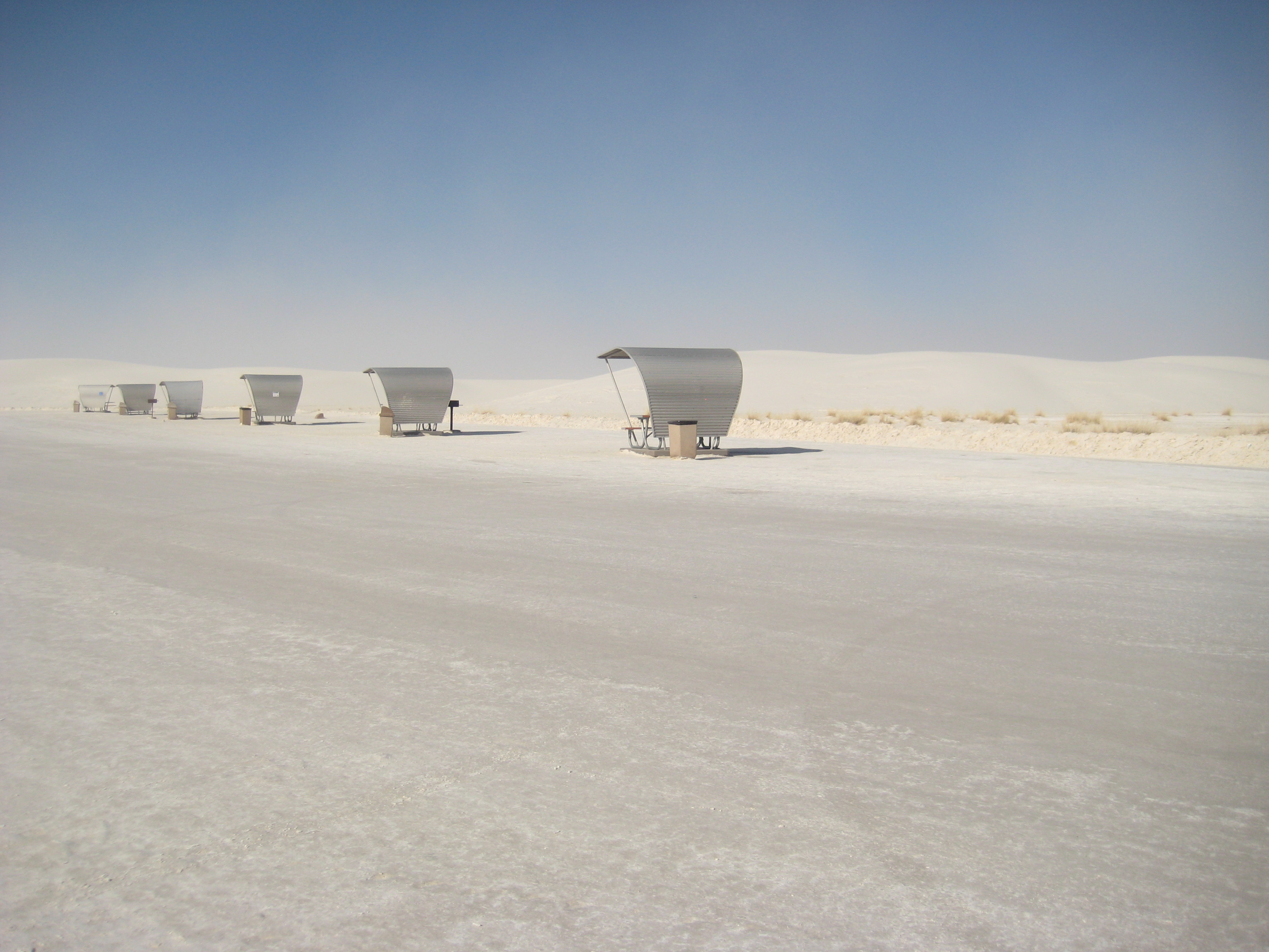
A paved road (the Dunes Drive) leads from the monument entrance on US 70 to the start of the sands 2 miles north. The road is paved for a while although blowing sand often covers the surface. Towards the center of the drive the surface is just compacted gypsum and the ‘road’ becomes a series of large cleared areas. The sands move up to 20 feet per year. As you drive everything is white, dazzlingly bright and capped on most days by a clear blue sky.

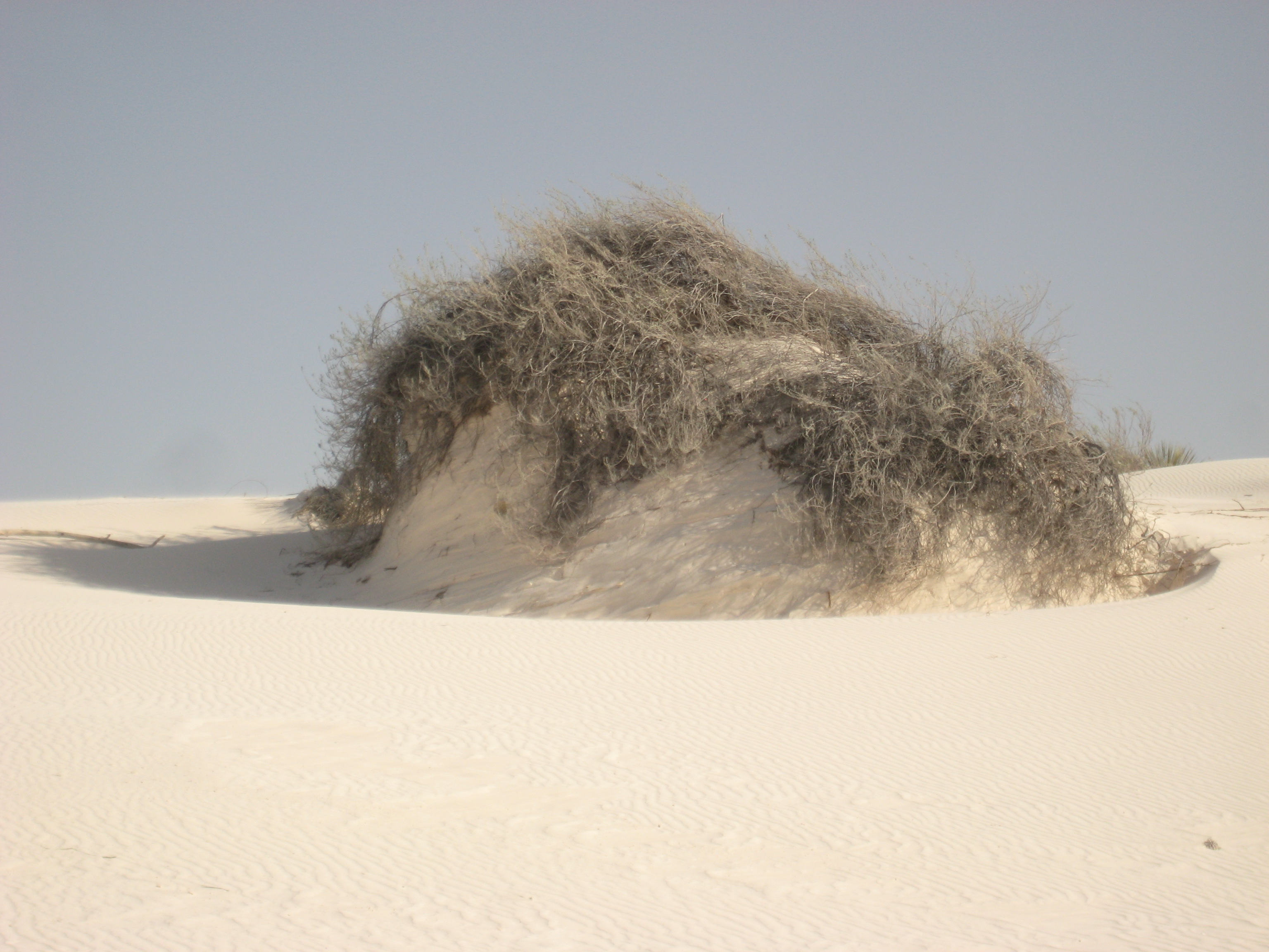
The most prominent plant in the dunes is the soaptree yucca, a species with numerous thin narrow leaves and an extensive root system that can stabilize a mound of sand and remain in place after wind causes the surrounding dune to more away. It also supports a limited range of wildlife, some of which has evolved white coloration to match the white dunes, and exist as species unique to this region only, such as the white sands wood rat, the Apache pocket mouse, and several lizards.

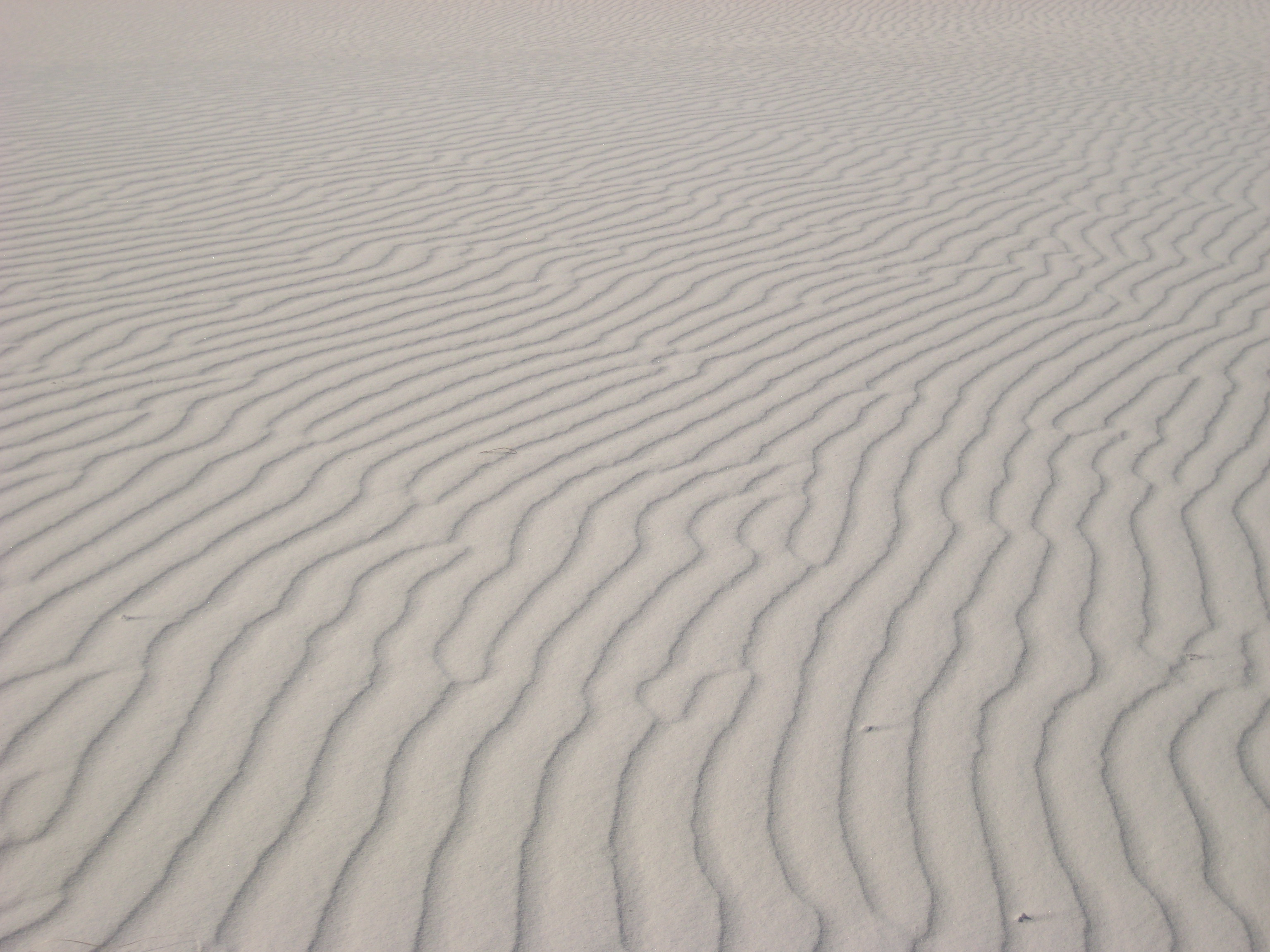
As we drove through the miles and miles of dunes we noticed the quiet solitude and the varied patterns in the sands of the wind swept dunes. There were no footprints , just wind-created ripples and occasional lizard tracks….. a beauty all its own.

Friday, February 25, 2011

Last fall, while “making time” heading to South Dakota from Wisconsin, we were approaching the town of Pipestone, MN. and we discovered there was a National Monument in the town. Being we are great fans of our wonderful National Park System we decided to check it out. Not only did we find a Nat’l Monument but also a really unique little town. The town contains 20 historic buildings built in the time period of 1880-1900 and all are made of the beautiful Sioux quartzite. The Pipestone County Courthouse (below) is a wonderful example of the beauty of the stone. The courthouse itself is basically a 100 x 75 foot rectangle, with a 110 foot renaissance dome topped by a bronze figure of “Justice,” which gazes north over the city. The tower features four clock faces, permanently set at different times.

The Pipestone National Monument is a “must see”. For countless generations, American Indians have quarried the red pipestone found at this site. These grounds are sacred to many people because the pipestone quarried here is carved into pipes used for prayer. Many believe that the pipe’s smoke carries one’s prayer to the Great Spirit. Indians used many pipes but those made from redstone were the most esteemed. Today only Native Americans are allowed to quarry the redstone and visitors are encouraged to watch live demonstrations of pipes and crafts being carved. Also do not forget to take the walk through the coteau prairie back to a great view of Winnewissa Falls…..a very enjoyable and easy walk.

Besides the wonderful architecture and Pipestone Nat’l Mon.. the town has a lot to offer from Native American History to the latest in wind technology with over 1000 wind turbines located in southwest corner of Minnesota.

….a jewel of a small town

If you would like to take a fascinating walk through a small town’s history, you should definitely visit Ashland, Wisconsin, and do the mural walk in the downtown business district. What started out as a “one-only” mural to celebrate the state sesquicentennial celebration has resulted in an entirely different purpose. The mural was so popular that the mural artists, Sue Martinsen and Kelly Meredith, were commissioned to do more and it blossomed into more than 11 murals over 12 years. It has turned Ashland into the Mural Capital of Wisconsin and the mission now is to promote art, history, and tourism to the area. The 8 block main street business district, where the majority of the murals are located, is listed on the National Register for Historic places. The murals display the history of Ashland i.e., founders of Ashland, lumberjack industry, WWII veterans of the town, area lighthouses, early storefront establishments, 1940′s waitresses, 1950 icons, and the iron ore docks to name a few.
The icing on the cake is that there has never been a problem with graffiti on the murals and the artists feel safe in just leaving their painting gear when they leave the various sites. It is always there and untouched when they return. Perhaps the murals are treated with respect because the community as a whole feels such a strong a sense of pride in them.
We stayed in Kreher Park, which is right in Ashland, located on Lake Superior and is an RV only campsite. We had a beautiful site right on the water and had awesome sunsets. It is a lovely park withvery reasonable rates. The Northern Great Lakes Visitor Center is a don’t miss stop, 2.5 miles west of Ashland off Highway 2. Interactive exhibits, multi-media theater, museum, gift shop, and 5-story observation tower. And while in the area, don’t miss the Apostle Islands which is another story in itself….

…..lucky rainy day

Due to bad weather and travel conditions, it was by happenstance that we stopped at Porcupine Mountains Wilderness State Park in the U.P. of Michigan. Dedicated as a state park in 1945 to protect the last extensive tract of old-growth hardwood and hemlock forest remaining in the Midwest, it is the Midwest’s largest wilderness area. Located on the western edge of the U.P, the park contains nearly 60,000 acres of virgin forest on the shores of Lake Superior. Eastern hemlock (some over 600 yrs old), sugar maple and yellow birch dominate the 35,000 acres of old-growth forest in the park.
The “Porkies”, as they are fondly referred to by the locals, stopped growing a long time ago and millions of years of erosion have worn them down. The highest point in the park is only 1300 feet above lake level. But the area is by no means flat….the Porcupine Mountains themselves arise abruptly from Lake Superior to form a 12 mile long escarpment which parallels the lakeshore for a distance of 1.5 miles and at 2 billion years old, the mountains are a section of one of the oldest mountain chains in the world.
On the landward side of the escarpment is Lake of the Clouds, which is one of the spectacular views to be found from high peaks in the area and is one of Michigan’s premier scenic locations. On a clear day, you can see more than 25 miles to the west.
But even though the mountains have eroded over millions of years, the end result are a number of beautiful waterfalls that were formed. The largest and easiest to visit are the waterfalls on the Presque Isle River on the western edge of the park. Manabezho Falls is the most impressive of these…..many of the waterfalls were named from the language of the Ojibwa Indians. This is the largest waterfall in the park and so it is named ManabehzoManbezho Falls after the powerful spirit God of the Ojibwa.
There is a beautiful boardwalk that follows the river and some of the falls and makes for great photo-ops. Nawadaha Falls is another waterfall…….in the spring of the year the river swells with rain and melting snow and peak flow reaches 12,000 gallons every second. The excellent water quality of the Presque Isle River makes it choice habitat for many species of fish such as brook and rainbow trout which are found year round. We stayed in the campground near the park entrance and our campsite was right on Lake Superior. It was one of the most enjoyable camp sites we have ever had.